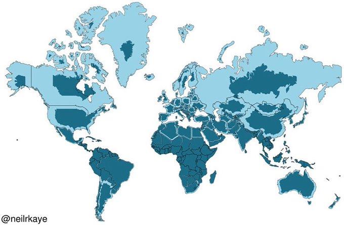
Actual size of the world countries.
Against "stressed to fill up the gap" size we normally see on everyday maps. Which is the result of projecting a 3D sphere surface over a 2D rectangular image.
Russia America and Canada aren't as large. And Africa is larger than you thought. Greenland is far smaller than how it's drawn.
